
Editor's Pick
How Grocery Delivery Companies Optimize Route Operations With Dynamic Geofencing
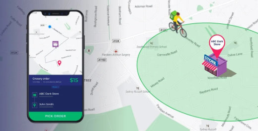
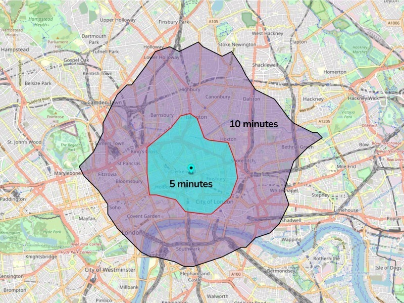
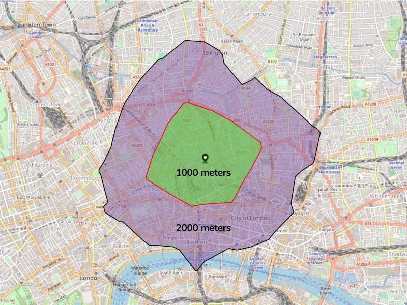
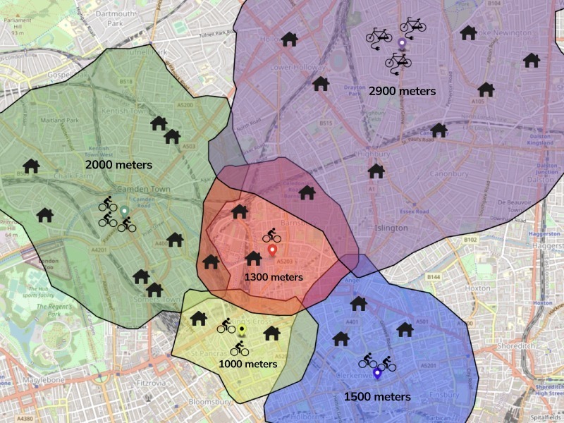
For grocery delivery operations in cities, we want to assign orders to delivery bikers in such a way that it minimizes the overall travel distance or time. With the large number of dark stores and the geographical distribution of orders across a given city, one way to approach this problem is by simplifying it. Instead of taking into account all the orders and all the dark stores in a city at a given time, why not divide the city into smaller zones, each centered around a dark store with a set of bikers assigned to each store? The question then becomes, how can we designate meaningful zones for deliveries? Creating isodistance or isochrone geofences is an effective approach. An isochrone map showcases all the areas accessible from a specific point (the dark store) within a certain time window. For example, the map below depicts the number of drop-off points a delivery rider can reach within 5 and 10 minutes from a selected dark store/warehouse. Drawing a straight line between a starting point and a destination would give us the most direct route. But when traveling by road, we don’t drive as the crow flies. Isochrone map To compute this perimeter, we take into account: Isodistance maps are built on the same concept, but here ‘time’ is replaced by ‘distance’. For example, the map below depicts all the possible locations (drop-off points) that are within 1000 and 2000 meters (bike ride distance) from a selected dark store/warehouse. Isodistance map To compute this perimeter, we take into account: For the grocery delivery use case in cities specifically, isodistance works better than isochrone because the typical vehicles used are bikes, cargo bikes or e-bikes. These vehicles are not as affected by traffic as cars or trucks, and they have access to dedicated bike lanes, so distance is a better optimization metric than time. Using API endpoints, companies can dynamically generate multiple geofences in varying sizes as per their business requirements. Geofences for each order pool Assessing the size of each fence is a business decision that could be dependent upon: These geofences can be dynamically created based on the variability (number of riders available) of the parameters listed above. Once geofences have been set, they can be used to automatically assess which geofence a particular order belongs to. All the orders that fall into specific geofences will be pooled for further delivery optimization within that geofence. If an order falls into overlapping geofences, custom rules can be applied to automatically assign the geofence it should fall under. These rules could assess: Dynamic geofences help simplify the order pooling process, i.e., allocating orders to the appropriate dark store. This solves the first part of the problem. Now let’s move on to the second — i.e., assigning each biker a set of orders and optimizing the delivery sequence of these orders. Automated order assignment Getting order assignment and the fulfillment sequence right is the most important part of solving grocery delivery’s operational challenges. With dynamic geofencing, you can account for operational constraints and assign a geofence to each set of orders and dark stores. But to optimize dispatch, order assignment and the sequence of order fulfillment, you will need Dynaroute The Dynaroute would help compute the fastest, shortest and most efficient routes for your delivery fleet to reach customers within the promised time. The Dynaroute can be fed into a Capacitated Vehicle Routing Problem Engine (the Solver) to generate the order grouping per biker along with the optimal order sequence for each delivery group. By combining the power of dynamic geofences with our Route Optimization program , we help grocery delivery businesses ensure that all on-time delivery KPIs are met without putting a strain on operations. Dynaroute in action Geofences also enable companies to gauge the size of the vehicle fleet needed in a city/area and add the right type of vehicles (for instance, add more EVs in areas with difficult road networks like steep slopes). Grocery delivery services can also understand if they need to expand or trim down the size of the driver fleet to meet demand in certain geographies during specific hours of operation. The biggest USP of optimizing route operations with dynamic geofencing and our program is that you can customize and reset the route parameters as and when needed — even if it means resetting the parameters multiple times in a day. The geofences can be recreated and the routes can be recomputed based on the: The underlying concepts of dynamic geofencing can be applied to other use cases and industries, such as ride-hailing, food delivery, e-commerce and hyper-local courier services.Creating dynamic geofences with custom rules
Pairing geofences with Dynaroute’s Distance Matrix API

Increase operational fluidity